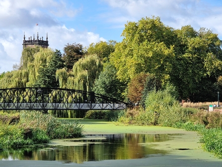
(c) Colette Cheney

(c) Colette Cheney
The Trent Valley Way is a brand-new walking path that retraces ancient trade routes and maximises your chances of spotting wildlife en route. Connecting Rugeley in Staffordshire and Shardlow in the outskirts of Derby, the 70 km walk passes several Derbyshire wildlife reserves. So why not make a reserve-hopping day out of it (without having to walk the entire path!)?
There’s something inherently reassuring about following the Trent on a walk. There is the practical side-it’s hard to get seriously lost with a sizeable blue ribbon acting as a rail guard. There is knowing that the route is ancient. Be it sea salt or cheese, traders have travelled via the Trent to reach their landlocked destination, and, of course, there is the Trent’s wild side.
Acting as a wildlife corridor, the Trent not only sees endurance icons such as the European eel and salmon pass through, it also acts as a lifeline for migratory birds navigating to their nesting grounds via the river. While some walks want to be fine-tuned to wildlife’s seasonal movements, there is a good chance that wildlife will cross your path on any given day, but adding a reserve stop can boost your chances and caffeine levels.

Heading to Newton Solney / (c) Colette Cheney

Newton Solney/ (c) Colette Cheney
Walk from Drakelow-Willington ca. 16km
Start your day in Drakelow - just outside of the Burton-on-Trent. The Trent Valley Way runs past the golf course on the other side of the reserve and parallel to the river. Following a wildlife reserve wander, head towards Ferry Bridge, a 1.8-mile walk, before you join the Trent Valley Way.
Wandering through Burton-on-Trent’s Washlands, a floodplain at the heart of the city, the route heads through rolling hills and farmland towards Newton Solney, where the River Dove confluences with the Trent. In late autumn and early winter, salmon take a turn and enter the Dove to spawn. The removal of Dovecliff weir, which had been in place for over 900 years, now opens up the journey for the salmon. Following an optional pitstop in Newton Solney, a medieval market town once famed for its fisheries, walkers once again follow the Trent’s path.
The market town of Repton is the next pitstop on the map. En route, walkers wander parallel to Willington Wetlands Nature Reserve. Briefly crossing Repton, walkers can either call in on their final destination by crossing the river via Willington Road.
Others may wish to call the former gravel quarry, now home to Willington Wetland’s growing beaver family, a pitstop.

Kings Newton/ (c) Colette Chene
Head on to Shardlow ca. 20km
Re-join the Trent Valley Way and continue to follow the Trent and the squiggly line it forges through a mostly rural landscape. En route, more gravel pits turned wildlife havens mark the Trent’s journey before walkers cross the river and then follow the Canal towpath on their final push to Shardlow. En route, Witches Oak Water nature reserve comes into view. The reserve comprising large wetland areas sits in close proximity to a gravel extraction site and can only accessed by appointment. Shardlow, in the outskirts of Derby, marks the final stop on this section of the Trent Valley Way. After 35 km of walking, plus some more in the nature reserves, it is time to call it a day.

Canal towpath to Shardlow (c) Colette Cheney
Go all in
While the Rugeley and Shardlow section marks the end of the latest section of the Trent Valley, those who get their kicks out of multi-day walks can keep on walking all the way to the sea, as the Trent Valley Way now stretches 143 miles from Staffordshire to its North Lincolnshire confluence with the Humber Estuary. The route would take 9-12 days to complete and can also be broken down into section walks.
The ambition is for the Trent Valley Way to become a source-to-sea walking path, so stay tuned!
Find out more about the exact route here:
This part of the Trent Valley Way is part of the Transforming the Trent Valley initiative and was made possible by the National Heritage Lottery Fund and Tarmac Community Fund.
