Rewilding Britain/ Sam Rose - whatifyoujustleaveit.info
Rewilding the Landscape
Everything works better when it’s connected
Over the last few decades, incredible effort has gone into protection and restoration of nature reserves, creating rich habitats and safe havens for wildlife. However, the landscape surrounding these reserves has continued to be degraded and has become more and more fragmented, with urbanisation and intensive agriculture dominating and forcing wildlife into smaller, isolated patches.
Now is the time to change the way we manage our land - we need to think big and manage at a landscape scale, aiming for bigger, better and more joined up.
What is a Nature Recovery Network?
A Nature Recovery Network is a joined-up system of places important for wild plants and animals, on land and at sea. It allows plants, animals, seeds, nutrients and water to move from place to place and enables the natural world to adapt to change. It provides plants and animals with places to live, feed and breed. It can only do this effectively if, like our road network, it is treated as a joined-up whole. To be successful, we must ensure that nature and connectedness is incorporated into all aspects of land management and developments, from creating green bridges over roads for species dispersal to diversifying agricultural lands to restoring our current habitats into better condition.
Why do we need Nature Recovery Networks?
Biodiversity is declining at an alarming rate. Globally, estimates suggest that natural ecosystems have declined by 47% with around 25% of all assessed species already threatened with extinction. That’s around 1 million species facing extinction in coming years and despite many years of conservation efforts, the decline continues to accelerate at an unprecedented rate. In Britain alone, the latest State of Nature report found that in the preceding decade, 44% of species had decreased in abundance and 37% in species distribution. These figures paint an alarming picture and unfortunately both in Britain and globally we have failed to fully meet any of the Global 2020 Biodiversity targets, although some progress has been made.
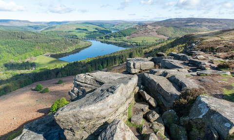
The Peak District is host to a diverse range of threatened species and habitats. This includes a number of UK priority habitats (as defined by the National BAP) such as high value blanket bog and dwarf shrub. These vital habitats support a number of internationally important breeding bird populations as well as further nationally and internationally important flora and fauna. Over recent years, there has been considerable effort made to preserve and improve degraded habitats in the region. However, not all habitats are currently being managed appropriately and unfortunately the area continues to experience a loss of key species and habitats including flower rich meadows, limestone grassland and limestone heathland.
In order to reach a sustainable future and stop further loss of critical species and ecosystems, we need to make more space for nature and give it the opportunity for nature to heal itself - rebuilding degraded ecosystems and restoring natural processes.
How do we create Nature Recovery Networks?
The main way that we can build Nature Recovery Networks is through people! This could be through local councils amending the way they manage greenspaces, or through local wildlife groups becoming established and individuals and landowners altering the way they manage their land whether that is something small such as a garden to something much larger!
Wild Peak seeks to inspire and mobilise nature recovery in the Peak District, inspiring and supporting people, councils and community groups to establish Nature Recovery Networks in their area.
Nature Recovery Network and Opportunity Mapping
Opportunity maps are a means for us to ensure that the work we do in creating these corridors and habitats is accurate and worthwhile. Creating Nature Recovery Network maps and using GIS analysis can help us to identify where good habitats currently are, where habitats should be and key bottlenecks in the landscape. We can use this to guide us to identify what work we should be doing -
- What habitats are missing from the landscape?
- Where does habitat need to be created to form a corridor?
- What habitats are already a part of a vital habitat network and should be retained?
- What works are needed for the survival of a specific species?
At Wild Peak we have now completed the process of NRN modeling within the area boundary and have conducted analysis on these results, allowing us to create an action plan to create joined up networks across the Peak District to allow species to move.
The results of this mapping is something that we are looking to share with like minded landowners who are looking to manage their land for nature so we can support them in creating the right habitat in the right place.


